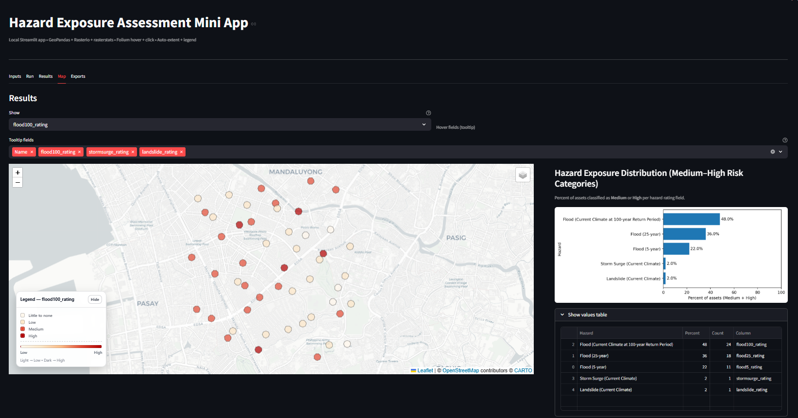
Enhancing Vs30 Mapping using HVSR Inversion
Poster presenter at GeoCon 2023 using HVSRInv (MATLAB) to estimate Vs30 for seismic hazard and site amplification, validated against Refraction Microtremor measurements.
I build asset-level hazard exposure metrics, scenario-driven comparisons, and clear visual narratives by combining spatial analytics, remote sensing, and workflow automation for planning, investment, and policy.
Personal dashboard to automate exposure metrics and visualization for distributed portfolios.
Standardized framework integrating local and global datasets for current and future scenarios.
Mapped turbidity patterns in GEE to identify potential siltation zones.
Hydrodynamic simulations producing flood depth and extent maps.
Processed multi-year NetCDF datasets to detect mesoscale eddies and track lifecycle evolution.
Conference presentations and research supporting multi-hazard and geospatial analytics work.
Poster presenter at GeoCon 2023 using HVSRInv (MATLAB) to estimate Vs30 for seismic hazard and site amplification, validated against Refraction Microtremor measurements.
Curated 54 cultural and historical records documenting “lost rivers” shaped by urban growth to surface links between buried waterways, flood memory, and community-led regeneration.
Geospatial framework analyzing interactions between multiple hazards, including cascading and compounding effects, supporting disaster risk assessment and resilience planning.
Remote sensing and geospatial analysis to characterize volcanic features within Benham Rise, supporting interpretation of submarine structures and regional geologic evolution.